GPXtoGPS View Garmin maps offline
View and search Garmin maps on a Mac or PC, offline
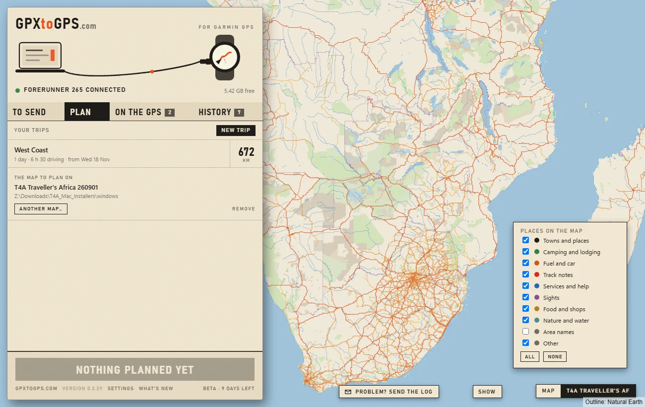
GPXtoGPS draws the Garmin map you plan on itself, from the file on your computer: its roads, rivers and towns, and its own places, such as campsites, fuel, lodges and track notes. It works without internet. FIND A PLACE searches those places by name, and one click adds a place to your trip.
By Rohan, who makes GPXtoGPS · checked 14 November 2026

What you can do on it
- Look around without internet: drag, zoom, and see the map as the GPS knows it.
- SHOW chooses which kinds of place appear: campsites, fuel, lodging, services and the rest.
- FIND A PLACE searches the map's places by name; + ADD makes one the next stop of the trip, under its own name. Clicking a place on the map does the same.
- Switch the map at the bottom right: satellite, a street map, or the Garmin map. The app remembers the choice, and without internet it always shows the Garmin map.
Which maps
- Unlocked Garmin maps: Tracks4Africa, and OpenStreetMap maps made for Garmin such as Freizeitkarte and OpenMTBMap.
- As you downloaded them: a .gmapi or .gmap, the folder a Windows installer fills, or an .img; the same file goes onto the GPS.
- ANOTHER MAP… lists the maps you have added, the maps installed on the computer (as BaseCamp or Garmin Express leave them), and Choose a File….
- Locked maps such as Garmin's City Navigator and TopoActive are named as locked, shown greyed out, and never used.
What it does not show yet
- Road and area names: the places are named, the roads not yet.
- The map maker's own colours and symbols: the app draws every map in its own style.
- Some of the extra kinds of place that OpenStreetMap maps carry.
Questions
Can I open a Garmin .gmapi or .img map on a Mac?
Yes, if it is unlocked. Drop it on the PLAN tab of GPXtoGPS, or choose it with ANOTHER MAP…: the app draws it with its places and plans trips along its roads. BaseCamp and Garmin Express are not needed.
Does it work without internet?
Yes. GPXtoGPS draws the map from the file on your computer, so it shows offline too, in the bush as well as at home.
Can it show Garmin City Navigator or TopoActive?
No. Garmin's own maps are locked. GPXtoGPS names them as locked, shows them greyed out, and never uses them.
Can I find a place by name?
Yes. FIND A PLACE in GPXtoGPS searches the places in the map, such as towns, campsites, lodges and fuel, and + ADD makes one the next stop of your trip. It does not search street addresses.