GPXtoGPS Trip planner
A trip planner for Garmin maps, on Mac and Windows
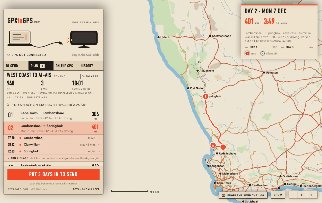
The PLAN tab of GPXtoGPS plans a trip along the roads of a Garmin map on your own computer, the same map your GPS drives on. You click the places; it works out the roads, the distance and the driving time of each day, and when you leave and arrive. Each day then goes to the Garmin as a route.
By Rohan, who makes GPXtoGPS · checked 16 November 2026
How a trip is planned
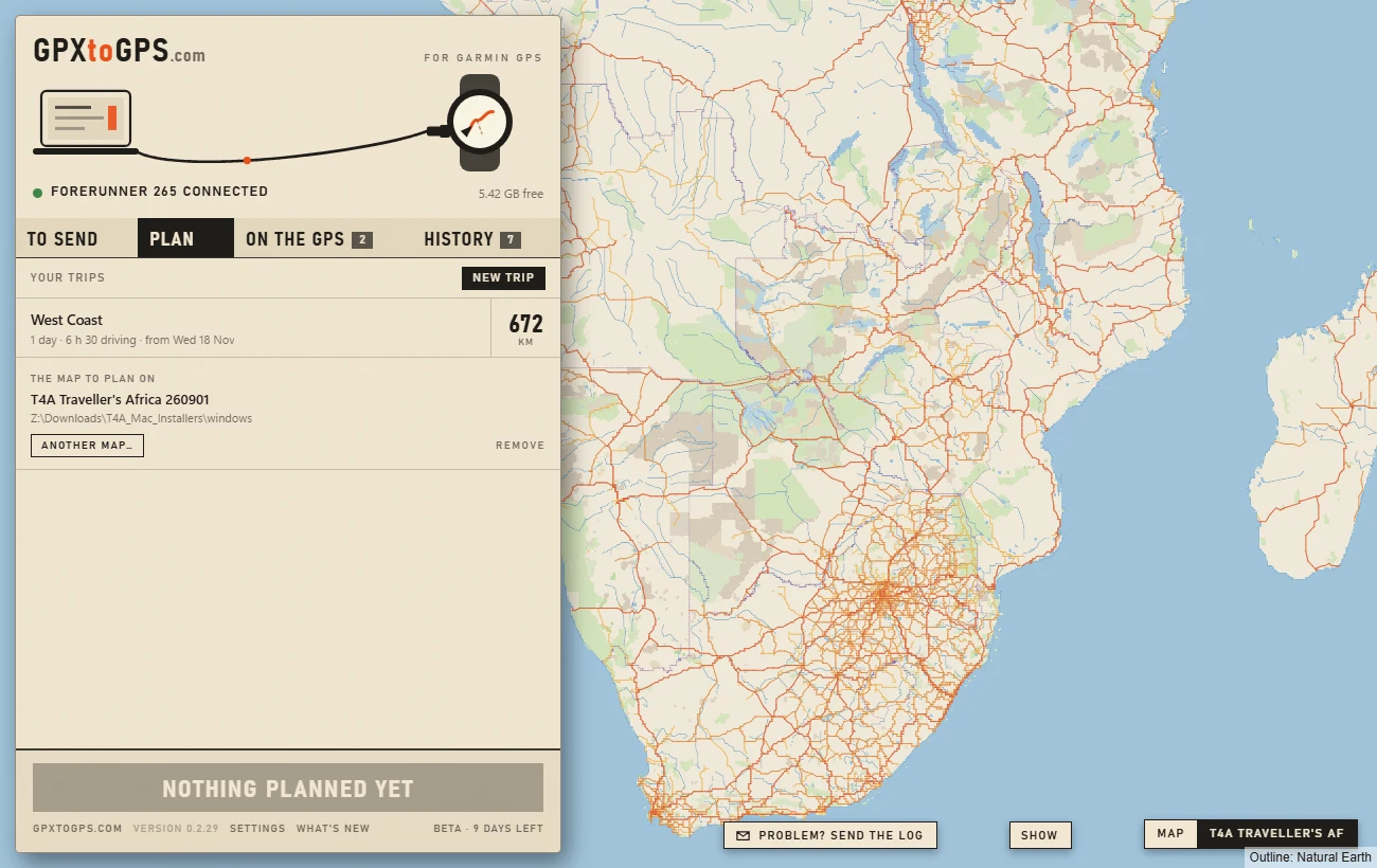
- Give it a map. Drop the Garmin map you downloaded on the PLAN tab, or choose it. It is the same file you drop to send the map to the GPS.
- Make a trip. Name it, and say which day it starts and what time each day leaves.
- Add the places, in the order you will drive them: click the map, click one of the map's own places, or find it by name with FIND A PLACE and + ADD. The app finds the roads between them and shows the distance and driving time.
- Say what each place is. A stop with a stay ("45 min"), the night at the end of a day, or a silent pin the route only passes through. Places can be named, moved earlier or later, and removed.
- Split it into days. Mark the nights yourself, or open TRIP SETTINGS and give the most hours you want to drive in a day: each day then ends at the last of your places it reaches in that time.
- Put the days in TO SEND. Each day becomes a route for the GPS, its stops announced, and is sent like any other route.

The map you plan on, with its places
The map behind the trip is the Garmin map itself, drawn by the app from the file on your computer: its roads, rivers, towns and its own places, such as campsites, fuel, lodges and track notes. It is there without internet too. SHOW chooses which kinds of place appear. Viewing Garmin maps offline.
FIND A PLACE searches those places by name. + ADD makes one the next stop of the trip, under its own name; clicking a place on the map does the same. More about the map.

Drag the line onto another road
Put the pointer on the day's line and drag it. While you drag, the line as it was stays dashed and a straight line follows the pointer; let go on a road and the day goes along it, through a new silent pin there. The pin is like any other place of the trip: name it, move it earlier or later, make it a stop, or remove it. Let go too far from a road, or at sea, and nothing changes.

The heights of a day
GRAPH, with the map's buttons, shows a band under the map with the heights along the day shown: the climbs and the passes, with the ascent, descent, highest and lowest. They come from the contour lines in the map file, so they are rough: on Tracks4Africa most contours are 200 m apart, closer in places, and in some parts of Africa the map has none, which the band then says. Move the pointer along the graph to see where that is on the map, and along the line on the map to see it on the graph.

Places of your own
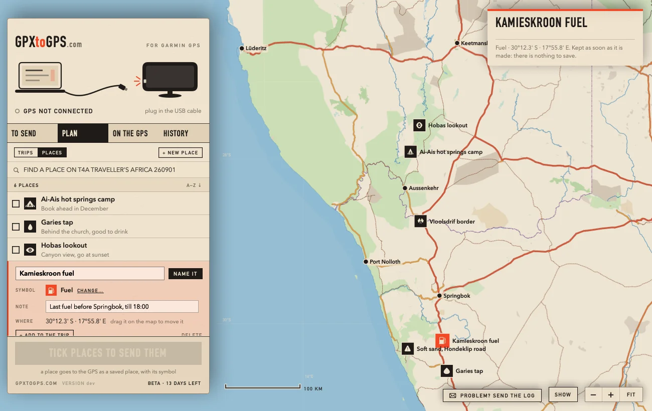
PLACES, beside your trips, keeps the spots you want to remember: a camp, a fuel stop, a view, a stretch of soft sand. Press + NEW PLACE and click the map, or find one by name and press SAVE. Give it a name, a symbol (camp, fuel, water, border post and more) and a note, and drag it on the map to move it. It shows on the map in every tab. Tick places and put them in TO SEND: they go to the GPS as saved places, with their symbols. BaseCamp called these waypoints.
Save it as GPX
SAVE AS GPX… beside TRIP SETTINGS saves the trip's days as GPX routes with their stops: one file, or a file each day, wherever you choose. For another app, a friend, or a backup.
How the roads are worked out
The app reads the roads and the routing data straight out of the Garmin map file, the way a Garmin does. It plans for a car, by the fastest or the shortest way (TRIP SETTINGS → THE WAY), and obeys one-way roads, roads closed to cars and turn restrictions.
Because the roads are the map's own, the plan matches what the GPS can drive. On the 16 Tracks4Africa routes used to tune it, a DriveSmart 66 took the same roads: every distance agreed to the kilometre.
Maps it can plan on
- OpenStreetMap maps made for Garmin with mkgmap, such as Freizeitkarte and OpenMTBMap. They are free and cover most of the world.
- Tracks4Africa, in any of its three downloads: the Mac .gmapi, the folder its Windows installer fills, or the .img. Tracks4Africa on a Garmin.
- Maps BaseCamp already installed on a Mac are found by themselves, if they are unlocked.
The map comes in as a .gmapi or .gmap, a map folder, or an .img. Planning reads that file every time, so the app asks you to keep it and offers to look after it in its own Maps folder.
Without any map you can still plan: the lines are straight between your places, the distance is rough, there are no times, and the GPS finds the roads.
What it does not do yet
- It cannot read Garmin's own locked maps (City Navigator, TopoActive).
- You cannot drag the rows to reorder the places; ▲ EARLIER and ▼ LATER do that.
- The heights of a planned day are rough: they come from the map's contour lines, not from height data.
- The times are for you: the files the GPS gets hold the route, not when you leave or how long you stay.
- The driving speeds were tuned on Tracks4Africa; on OpenStreetMap maps they have not yet been checked against a GPS.
- It plans by car only, the fastest or the shortest way (TRIP SETTINGS → THE WAY): no avoiding tolls or gravel yet, no walking or cycling profile.
Questions
Does the trip planner need internet?
No. In GPXtoGPS the roads, distances and driving times come from the Garmin map file on your computer, not from a server, and your trip is not sent anywhere. The map you click on is that same Garmin map, drawn by the app, so planning works without internet, in the bush too.
Can I plan on Garmin City Navigator or TopoActive?
No. Garmin's own maps are locked and GPXtoGPS cannot read them. Plan on an unlocked map of the same area, such as a free OpenStreetMap map from Freizeitkarte or OpenMTBMap; the GPS then drives the planned line on whichever map it has.
How good are the driving times?
In GPXtoGPS, the speed for each class of road was fitted to what a Garmin DriveSmart 66 shows for 16 routes on Tracks4Africa: within 3 minutes on each. On OpenStreetMap maps the same speeds are used and have not been checked against a GPS yet.
Will the GPS follow the roads I planned?
Each day is sent as a route with your stops, plus silent pins along the planned line that hold the GPS to it. After the GPS has imported the route, GPXtoGPS compares its version with yours and tells you if it strayed.
Can I find a place by name?
Yes: FIND A PLACE in GPXtoGPS searches the places in the Garmin map you plan on, such as towns, campsites, lodges and fuel, and + ADD makes one a stop. It searches the map's own places, not street addresses.
Can it plan the shortest way instead of the fastest?
Yes. In TRIP SETTINGS, THE WAY chooses FASTEST or SHORTEST for the whole trip, by car. The shortest way has fewer kilometres and often takes a little longer; each day still shows its driving time. GPXtoGPS does not avoid tolls or gravel yet.
Is the planner in the Windows app too?
Yes. GPXtoGPS for Mac and for Windows share the same road engine and the same trip files.