GPXtoGPS Tracks4Africa on a Garmin
Tracks4Africa on a Garmin, from a Mac or a Windows PC
Drop the Tracks4Africa map on GPXtoGPS as you downloaded it and it goes to the Garmin over the USB cable as the single file the unit reads. The same file lets you plan your trip along Tracks4Africa's roads on your computer, and send each day to the GPS as a route.
By Rohan, who makes GPXtoGPS · checked 16 November 2026
Looking for the Tracks4Africa Guide app? That is T4A's own app for iPhone and iPad, which also opens on Apple silicon Macs. This page is about T4A's GPS map on a Garmin.
The map: a drop instead of a manual
Tracks4Africa's own FAQ tells Mac users to install the map with Garmin BaseCamp and MapInstall (Will T4A work on a MACBook?). Both are Intel programs that need Rosetta 2 on an Apple silicon Mac, and T4A also notes that some Garmins run Android and cannot be reached from a Mac at all (Garmin GPS units and Mac computers). The official way onto a newer Garmin from a Mac runs to a 43-page guide, an SD card and three programs. With GPXtoGPS:
- Quit Garmin Express and BaseCamp, and plug the Garmin in.
- Drop the Tracks4Africa download on the app.
- Send. The map is checked, and anything it replaces is backed up on your computer first.
- Unplug the GPS, let it restart, and tick the map under Settings → Map & Vehicle → myMaps.
Plan the trip on Tracks4Africa's roads
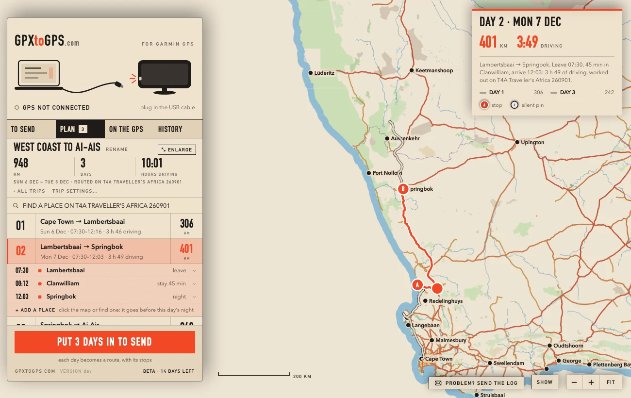
Drop the same download on the PLAN tab. Click your camps and stops, and the app works out each day along the tracks and roads of the map: how far, how long, when you arrive. The driving times were fitted to what a DriveSmart 66 shows on 16 Tracks4Africa routes, from tar to slow tracks: within 3 minutes on each. The trip planner.
Routes from a GPX
A trip planned elsewhere and exported as GPX works too. A DriveSmart ignores tracks, so each track becomes a route: your named stops announced, a silent pin about every 30 km to hold the Garmin to your line. After the GPS has imported it, the app checks that it kept to the line. GPX to a Garmin route.
On the GPS, before you leave
- Untick Unpaved Roads and U‑Turns under Settings → Navigation → Avoidances.
- In myMaps, tick only the one map of the area your trip was planned on.
Questions
How do I install Tracks4Africa on a Garmin DriveSmart from a Mac?
Plug the DriveSmart in, open GPXtoGPS and drop the Tracks4Africa download on it (the Mac .gmapi). The app packs it into the one .img file the Garmin reads and sends it over the cable. Unplug, let the GPS restart, and tick the map under Settings → Map & Vehicle → myMaps.
Which Tracks4Africa download do I need?
GPXtoGPS takes any of the three: the Mac download (.gmapi), the folder the Windows installer fills, or the .img.
Why does my DriveSmart send me round on tar when the route is on gravel?
A DriveSmart avoids unpaved roads by default. Untick Unpaved Roads and U‑Turns under Settings → Navigation → Avoidances.
Why does the GPS not follow the route on the Tracks4Africa map?
With two maps of the same area switched on, the GPS cannot route on both. In myMaps tick the one map the trip was planned on and untick any other of that area, Garmin's own included.
Is GPXtoGPS made by Tracks4Africa?
No. GPXtoGPS is an independent app, not affiliated with or endorsed by Tracks4Africa or Garmin. You buy the map from Tracks4Africa.